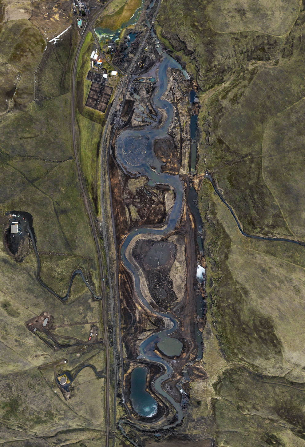
A river’s revival.
Restoring the Umatilla River to its original flow
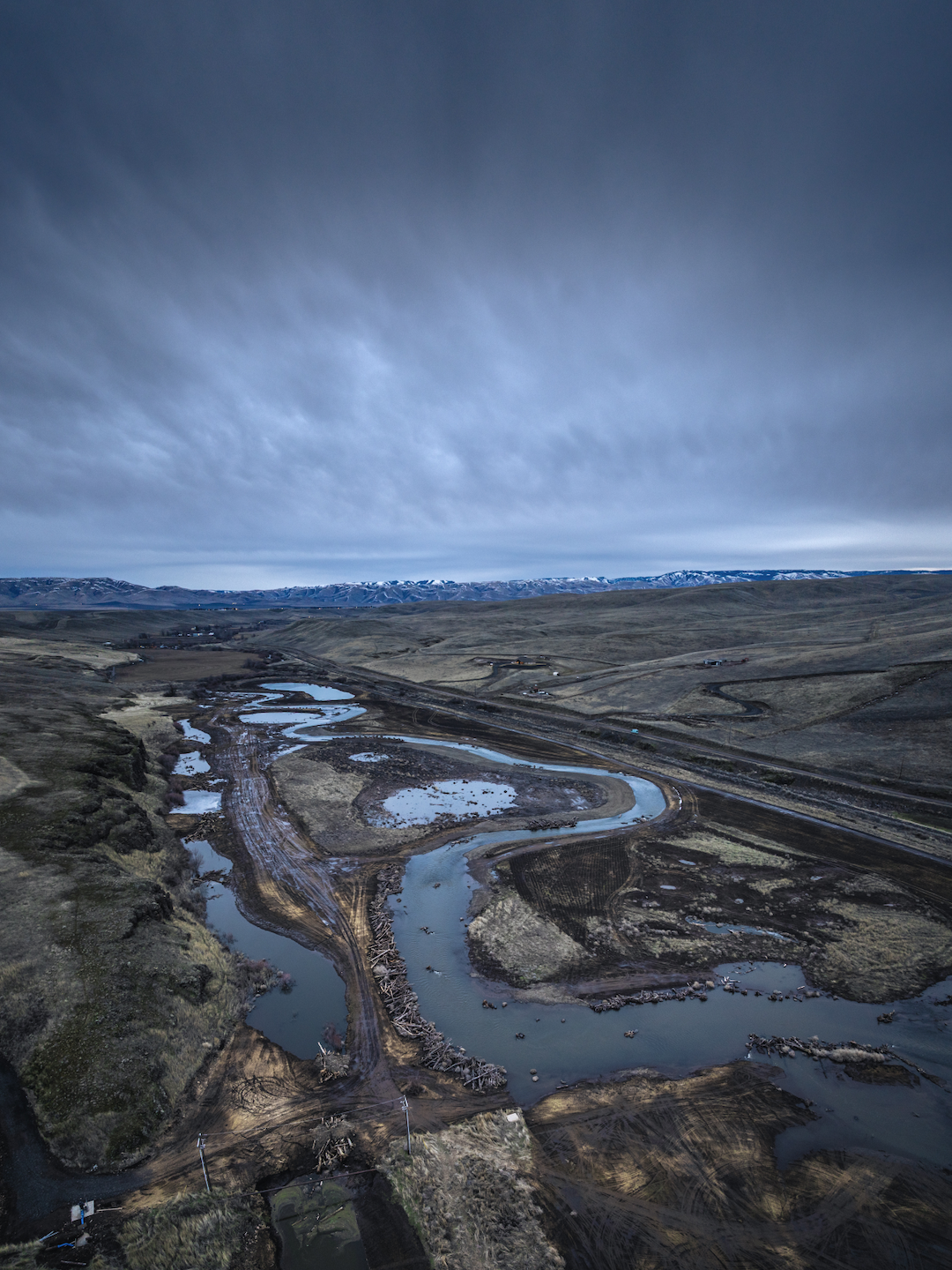
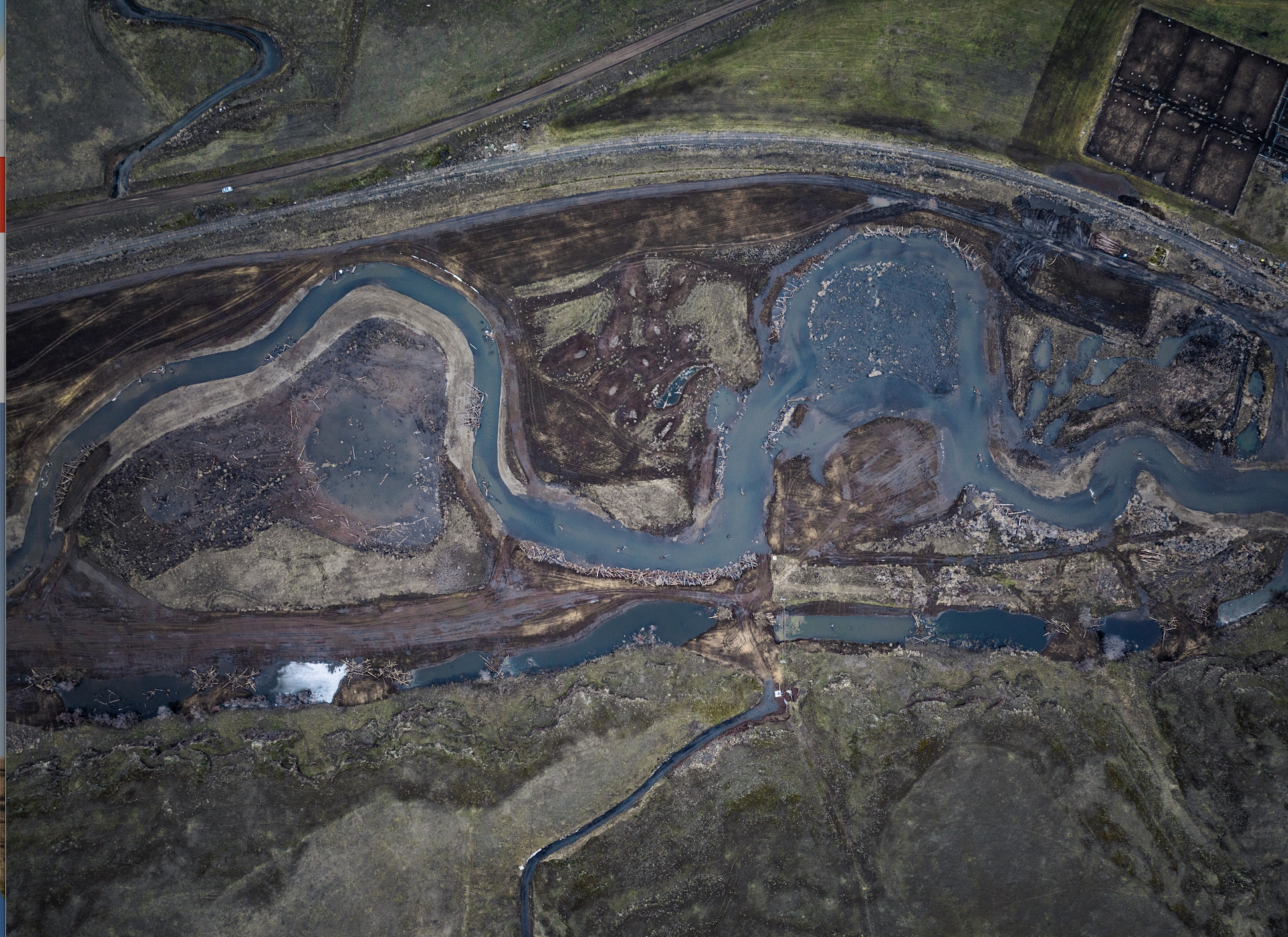
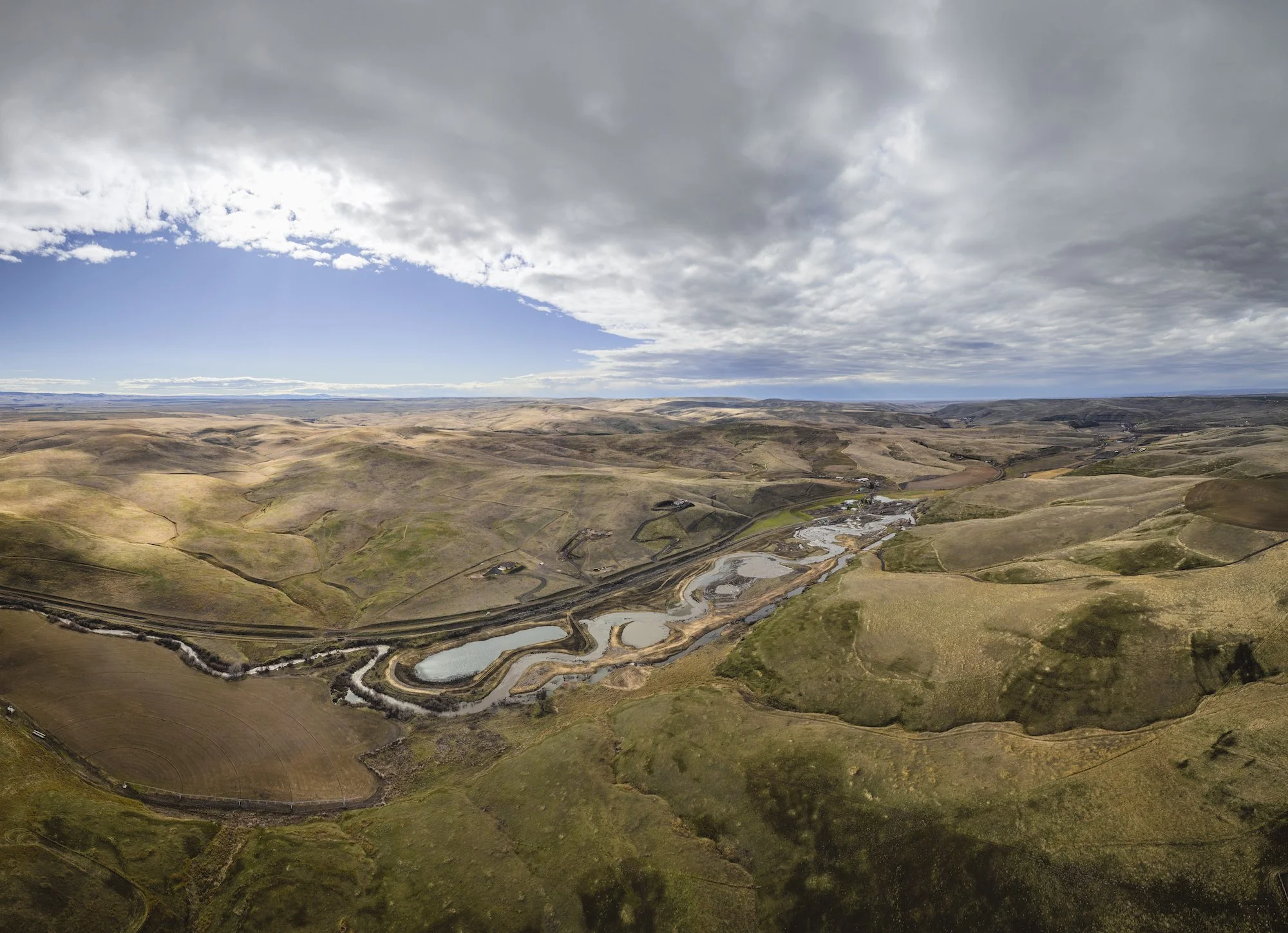
Just outside Pendleton, Oregon, where basalt cliffs meet short grass prairies, an ambitious restoration project is underway at the confluence of the Umatilla River and Birch Creek. This is no ordinary conservation project — it’s a collaborative effort on a massive scale and soon to be the largest floodplain restoration project in the Umatilla River Basin.
Through the dedicated efforts of the Confederated Tribes of the Umatilla Indian Reservation (CTUIR), fish populations now have a better chance at recovery in one of the most productive steelhead tributaries in the region.
Blue Mountain Land Trust is working to permanently protect CTUIR’s investment in the river restoration project to ensure its longevity, forever.
Photo by William Frohne
Photo by William Frohne
Photography by Justin Mordeno
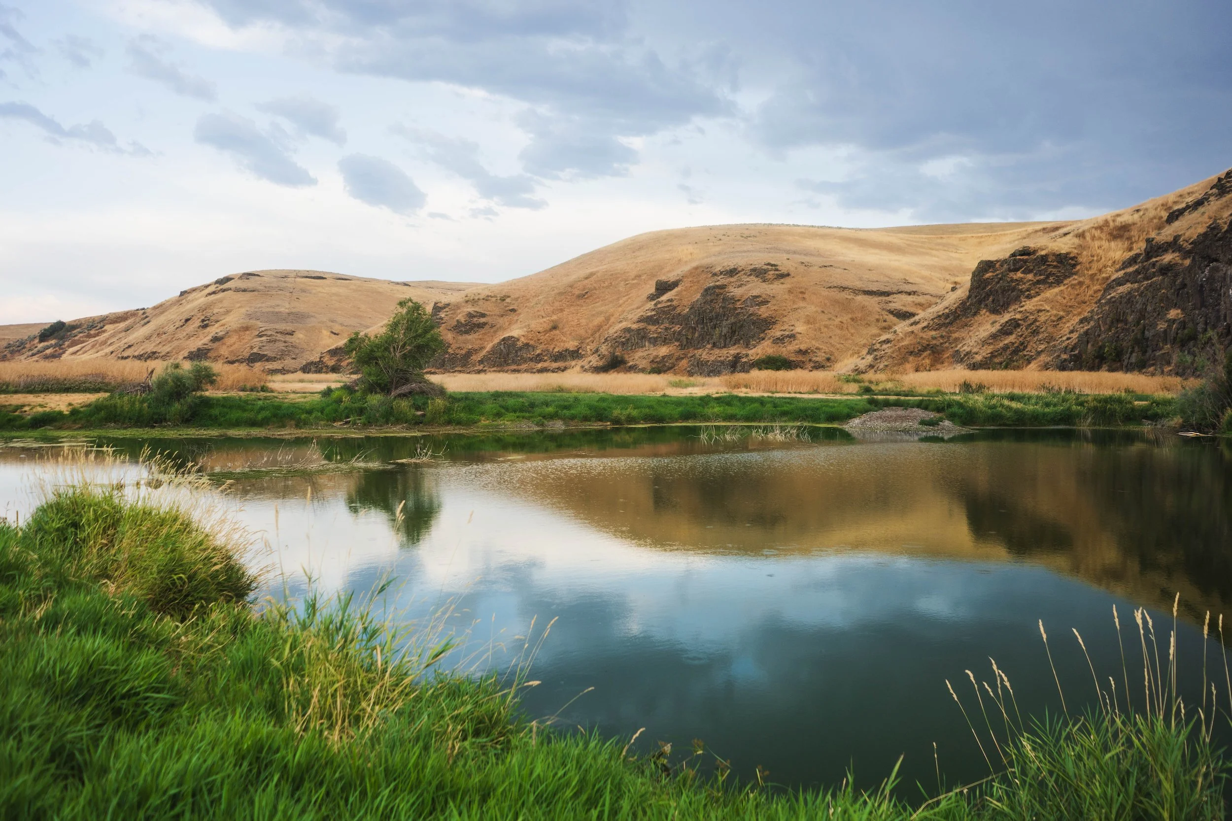
The Umatilla River flows 89 miles from Oregon’s Blue Mountains across the Columbia Plateau, reaching the Columbia River near Pendleton. Birch Creek meets the Umatilla River here, and is one of the most productive tributaries in the Umatilla River Basin for ESA-listed Middle Columbia steelhead, supporting 50% of all steelhead in the watershed.
The UmaBirch restoration effort is part of a larger movement in the U.S. and beyond, where Tribal nations are leading the way on expansive conservation projects. This project is just the beginning — a robust model that builds momentum for even more restoration across the region, bringing together Tribal expertise, community support, private landowners, and the vision for a future where rivers thrive naturally.
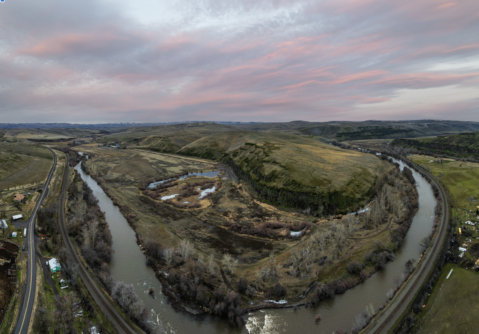
Throughout history, human attempts to control rivers by straightening their natural courses drastically disrupted these ecosystems. By channelizing rivers to flow in straight lines, water was forced to rush downstream like a fire hose, bypassing the natural meanders and floodplains that once absorbed floods and supported diverse habitats. This unnatural flow exacerbated downstream flooding, eroded the landscape, and left native fish — especially Middle Columbia summer steelhead — without the complex habitats they depend on for spawning and rearing. A wide range of native fish species also suffered from this habitat loss, leading to cascading effects throughout the ecosystem.
Guided by their First Foods mission and River Vision, CTUIR is dedicated to restoring the impacts of past river channelization. Their plan demonstrates how restoring natural flows and honoring the floodplain’s role can revitalize the river and surrounding landscape for native fish and aquatic species.
The restoration process reintroduces natural meanders and curves, allowing water to slow down and spread across the floodplain. By adding pools, side channels, and woody structures, the river gains essential habitats where fish can spawn, feed, and find refuge from predators. Levees are either removed or set back, letting high waters flow freely and reducing downstream flood risks. Finally, native vegetation is planted along the riverbanks, stabilizing soil, filtering runoff, and creating habitats for insects, birds, and other wildlife. Together, these steps enable the floodplain to function like a sponge, absorbing floodwaters and recharging groundwater supplies.
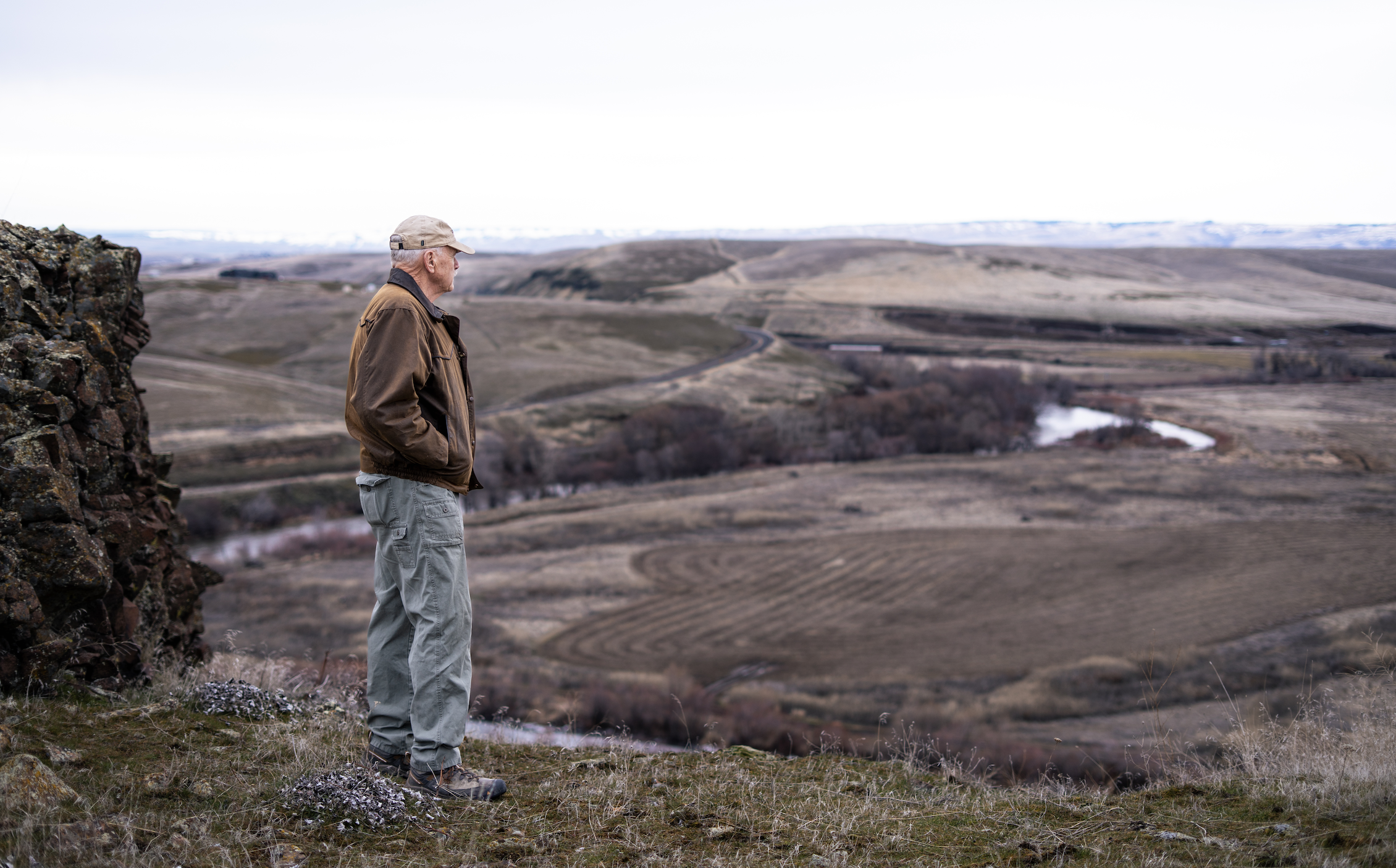
“As we know from floods, water goes where it wants to go. CTUIR will lay out the river path where it was historically, but it will move and change from year to year depending on high and low water levels,” said property owner Jim Whitney. “It will move around, but that’s nature and we’re going to let nature do what it does. It’s just one of the good things we can do for this type of property.”
Photo by William Frohne
Working together for future
The heart of this project is the floodplain restoration, but it’s only possible through the collaboration of private landowners and regional conservation organizations. Jim Whitney of Whitney Land Company knows a thing or two about the importance of connection between the Blue Mountain community and the natural world.
His real estate company specializes in agricultural properties and has worked with various conservation organizations on land transactions throughout Eastern Oregon. He’s also an avid fisherman and hunter, hiking 20 miles a week in the uplands of his property. When approached about the idea of a river restoration project and conservation easement, it was the obvious choice.
“The discussion I had in the beginning with CTUIR, it just made sense to do this with the property. I looked into it and could see their vision,” said Jim. “It will be an enhancement that will last forever in a location where many eyes will see and understand what conservation is and how we can do a better job with the land. It was the right thing to do, and it will make a difference for Eastern Oregon.”
Photo by William Frohne
Photography by Justin Mordeno
Photo by William Frohne
Flowing water, thriving rivers
In conjunction with CTUIR’s restoration, Blue Mountain Land Trust (BMLT) is working to permanently protect this critical landscape, including 3.7 miles of rivers and over 942 acres of the property. Through conservation easements, BMLT protects clean water, open spaces, and various habitats for fish, wildlife, and communities. The easement provides additional protections along the river, where sensitive management plans focus on improving water
quality and the river’s natural flow.
The conservation easement also includes the permanent instream protection of 227.57 acres, or approximately 3.525 cubic feet per second (cfs) of water that will be permanently transferred to remain in the river, enhancing year-round flow for fish and wildlife. Plants benefit as well. On a healthy floodplain with a higher water table, cottonwoods can grow up to 12 feet in a year. The result is a thriving riparian area: habitat for ESA-listed Middle Columbia summer steelhead, rainbow trout, Bull trout, fall Chinook salmon, Coho salmon, redband trout, Pacific lamprey, freshwater mussels, and other native fish.
“A river is nothing without water,” said BMLT Conservation Manager Fraser Moore. “The more water that can stay instream, the more a river can thrive.”
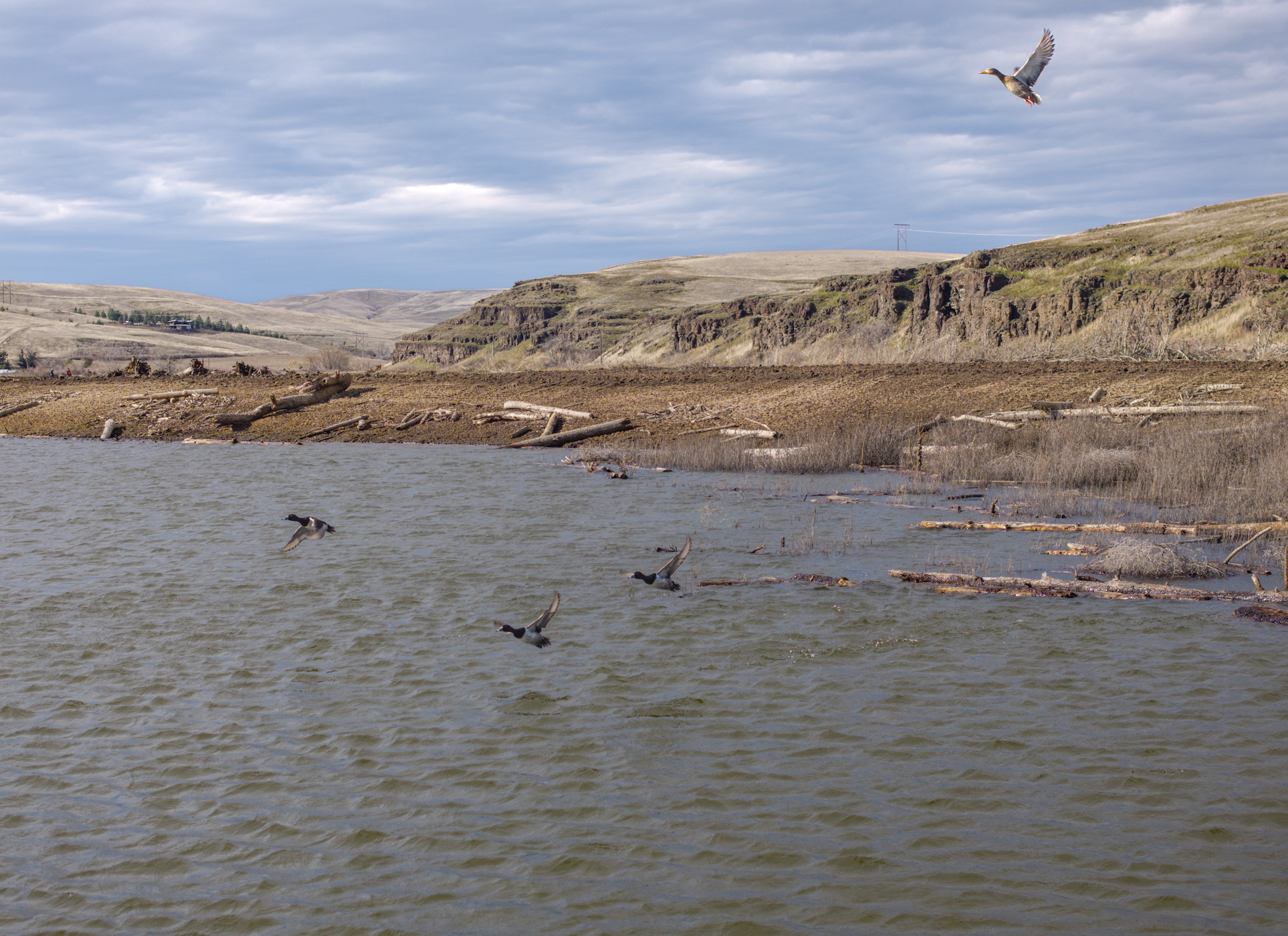
The benefits extend beyond the aquatic realm. Approximately 250 species of wildlife, including the bald eagle and river otter, rely on these habitats for survival. Protecting and enhancing the landscapes along the Umatilla River and Birch Creek provides a safe haven for these species, promoting biodiversity and ecological resilience.
“I enjoy the outdoors that Eastern Oregon provides to everyone. There’s a lot of open country to get out, whether hiking, fishing, hunting, or taking pictures. It’s the outdoors that I was raised in, and I value and want to protect it,” said Jim. “This is one of those areas where I can be a part of protecting a piece of property that is a significant location for fish and wildlife. It will improve the number of steelhead migrating successfully, meaning more opportunities for fish on the Columbia and Umatilla Rivers.”
As BMLT finalizes the closing of the UmaBirch Conservation Easement, we recognize this as a step toward ecological and cultural restoration. It is about supporting Tribal-led conservation initiatives to revitalize ecosystems and secure the future of the Umatilla River and Birch Creek. The result is a thriving landscape with diverse habitat, reduced flood risk for nearby communities, and a model of collaborative conservation that balances ecological health with community resilience.
This project is made possible through the collaboration of the Confederated Tribes of the Umatilla Indian Reservation (CTUIR), Jim Whitney, Blue Mountain Land Trust, Western Rivers Conservancy, and Bonneville Power Administration.
Photo by Wiliam Frohne
